Before you can take a look at the way the world was in your ancestor’s neighborhood or part of the country when they lived there, you first have to pinpoint the exact location of their house or property. When you do this, you may find that you often end up with information for their neighbors, which is worth saving. Those who lived close to historical ancestors may be relatives. So can previous or later owners of the same piece of land or house, or people who you discover were selling off parts of your ancestor’s land (if it wasn’t your ancestor personally doing the selling).
Also, keep in mind that in times past, it wasn’t as easy to go far distances as it is today. Therefore, most people courted close to home. Those neighbors of your ancestors might be in-laws or the future in-laws of your ancestor’s children….perhaps the children in your direct line. This can open up previously unknown family lines, simply by looking at the neighbors of your ancestor on a map.
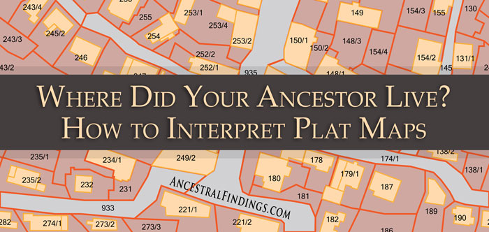
You’ve still got to find that property first. You might discover a description of the property, including its location, in old wills, bills of sale, newspaper announcements of judgments or sales, and land deeds. Depending on the period of time and the geographic area in which a piece of property was, be it a house, land, a business, or all of these together, you will find different measurement types to use in determining the location of your ancestor’s property.
The three most common old-fashioned ways of describing where a property is located are the metes and bounds method, the rectangular survey, and the numbered lots method. Of these, metes and bounds is the oldest method and was most in use when the colonies in North America still belonged to Great Britain, and for a bit after they became the United States.
The metes and bounds method uses both natural and man-made features of the land to describe the boundaries of the property. The description will start at one corner of the property, and then trace the perimeter of it in sections. Old-fashioned, and even ancient methods of measurements may be referenced on land records that use metes and bounds. You may find such ancient measurements as rods and chains, the lines of fences, easily identifiable trees, and even landmarks that may or may not still be there.
There are tools available online that can help you make sense of these descriptions and plot the exact location and boundaries of your ancestor’s property. The good ones are free plot platters like Plat Plotter. There is software you can buy that will also do this for you, such as DeedMapper for Windows and Metes and Bounds for Mac, Windows, iOS, and Android.
You can also do this yourself by finding a reference point on the land document that you can recognize or locate today, such as a river or a road. You can usually work the rest out from the land document if you can find a recognizable reference point on it. You can also trace the ownership of the land forward in time through land sale records until you find a modern deed and accompanying map that you can more easily understand. Deed histories also help you to confirm the land you’re tracing is the same piece of land through the generations and centuries.

