The First World War, World War I or The Great War as it was more commonly known at the time, began with the assassination of Archduke Franz Ferdinand in the Bosnian capital of Sarajevo and concluded with the ill-fated Treaty of Versailles in June 1919, although hostilities had ceased in November of 1918. The conflict drew in most of the major world powers and their empires in varying degrees of involvement saw huge armies like never before and the development of new weapons which contributed to the slaughter as tactics and strategy remained firmly in the 19th century.
It ended with tens of millions of casualties, the break-up of the Austro-Hungarian Empire, humiliation of Germany, saw the Bolshevik takeover of Russia and the near financial ruin of major world powers like Great Britain. In the end, it sowed the seeds of an even greater and more destructive conflict, but it also prompted new inventions, new ways of thinking and innovative problem-solving.
Aerial photography was just one of these and although military commanders may take it for granted nowadays, at the time it was an entirely new concept and it took some time for it to be readily accepted by commanders in the field. By the end of the conflict, however, aerial photography had endured and proved its worth, providing more than 5 million images from the RFC in the final year alone and paving the way for generations to come.
Air Forces of Combatants
At the start of World War I, powered aircraft were still very much a new invention, although most modern countries could already foresee their value in the future. Most nations who could afford an air force, developed them as unarmed reconnaissance vehicles and in this role, they undoubtedly excelled, but as the war progressed new ideas were put forward and the roles become more diverse.
Numbers were small and production of powered aircraft was slow at that time, compared with the much more efficient and productive factories that epitomized World War Two. Even by the end of The First World War, the RFC strength was just 3,300 aircraft, a number dwarfed later in the century and the French air force, consisting of just 132 machines in 1914, expanded to more than 2,000 in 1918.
But still, the major nations were able to employ some innovative ideas and the photographing of enemy positions, to give a more detailed analysis of their strengths and weaknesses, was one of the main uses, involving not just courage on the part of pilots. Necessity, as they say, is the mother of invention and the leap in the science of aerial photography in just 4 years was immense.
Balloons
Using balloons in the military was nothing new by the time the First World War began. In fact, they had been used by armies for more than 100 years before the conflict, first making their appearance in the Battle of Fleurus in 1794, and often being used to good effect.
Balloons were used as an alternative to cavalry units, to carry out reconnaissance of enemy units, gather intelligence and to prepare accurate maps of battlefields prior to any engagement. This last use proved to be extremely successful on many occasions and gave commanders a useful additional tool when it came to planning tactics.
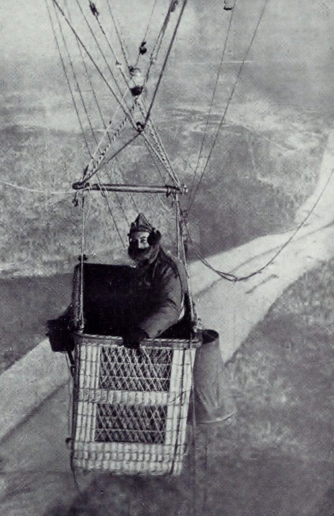
A French balloon observer, 1918 (Wikipedia)
In the 1860s, balloons were used in the American Civil War, allowing a spotter to direct artillery against targets they could not see for themselves. This was a military first and with the advent of photography, it was the forerunner to more advanced ideas just 50 years later.
In World War I both sides employed balloons and the British Royal Flying Corps (the forerunner of the RAF) soon employed their balloons in a variety of roles.
When the stalemate of the western front descended into trench warfare it was essential to have accurate maps as most that were available were of the Napoleonic era. Balloons could be used in this venture, although they were slow and vulnerable to air and ground attack and were generally kept behind the front lines and well protected by ground-based machine guns and artillery and from their own designated fighters.
Perversely, the use of aerial reconnaissance contributed to the stalemate in the trenches, as armies were unable to move around to new positions without being spotted and intercepted. It was around this time that balloon observers and pilots became the first to wear parachutes, giving them more of a fighting chance in the event that their craft suffered catastrophic damage.
Aircraft
By the end of 1914, the first Photographic section was formed by the RFC and soon proved its worth, providing detailed and accurate photos of battlefields.
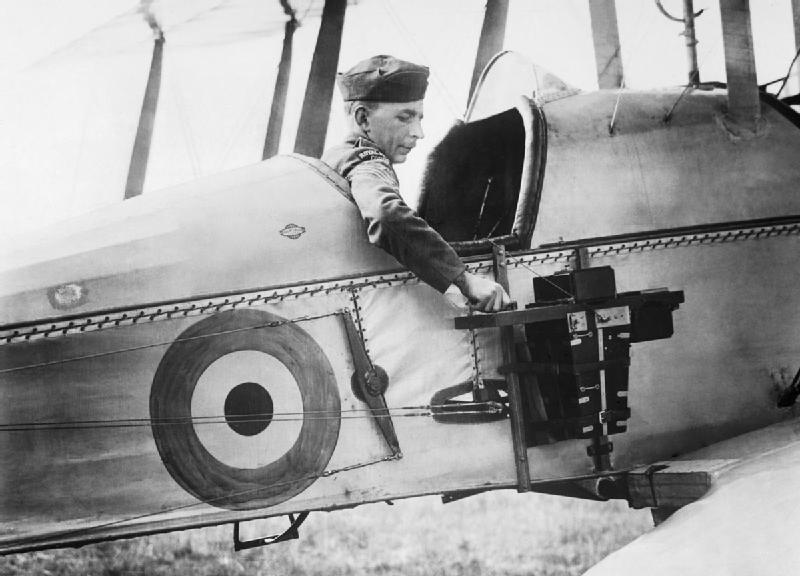
An observer of the Royal Flying Corps in a Royal Aircraft Factory B.E.2c reconnaissance aircraft demonstrates a C type aerial reconnaissance camera fixed to the side of the fuselage, 1916 (Wikipedia)
It was a hazardous enterprise in the early days, with the observer having to literally hang over the side of the aircraft and take the images with a camera which by today’s standards was of poor quality. It required a steady hand and nerve and an ability to cope with freezing temperatures at heights of around 5,000 feet, while all the time waiting for an enemy attack which could threaten almost certain death.
As the war progressed so did camera designs, which allowed for better and more detailed photos to be obtained. Semi-automation also meant that photographs could be taken and processed with greater speed. One demonstration, in 1916, proved that from the moment of taking a photograph to place it in the hands of someone who could use the information took just 49 minutes.
Clearly, this was exceptional and took no account of factors which could influence it, such as enemy activity, accidents or other potential problems, but it showed that it was possible at least.
Millions of images were captured during the conflict, and the speed with which they were developed and processed by ground commanders kept pace throughout the war, giving an enormous advantage to both sides.
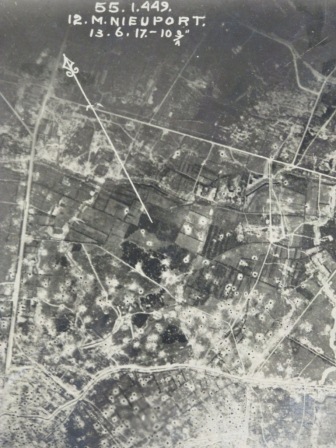
Aerial photograph showing the ‘lunar’ effect of heavy shelling. (catalog reference: WO 316/13/26) The National Archives UK
Zeppelins
The Zeppelin was a curiously German invention and played its part during the war, bombing Paris and London and causing more fear of its capabilities than actual damage or loss of life. In the North Sea, it was used almost exclusively in a reconnaissance role and flew more than 1000 missions against Allied shipping, gathering much-needed intelligence.
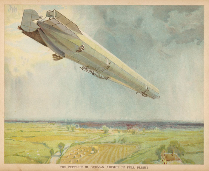
German Zeppelin
The Battle of Neuve Chapelle
Although photographing enemy positions was commonplace, even at the start of the war, it wasn’t until 1915, during the battle of Neuve Chapelle, that it was used to plan a large engagement. By this time, the science behind taking aerial photographs had improved and some of the more enlightened army commanders were beginning to see the value of them.
So, when it was decided to make an attempt to break through the German lines, several hundred photographs were taken and then made into some 1,500 maps which were distributed to the infantry commanders.
As the attack went in, aerial observers coordinated artillery and continued to take more images of the progress, but in the end, a mixture of communication breakdown and German reinforcements halted the attack. Despite the failure of the attack, the engagement showed that the images gained had increased in their sophistication and were of immense value when interpreted and exploited correctly.
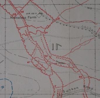
Trench map detail east of Hebuterne (catalog reference: WO 297/6639) The National Archives UK
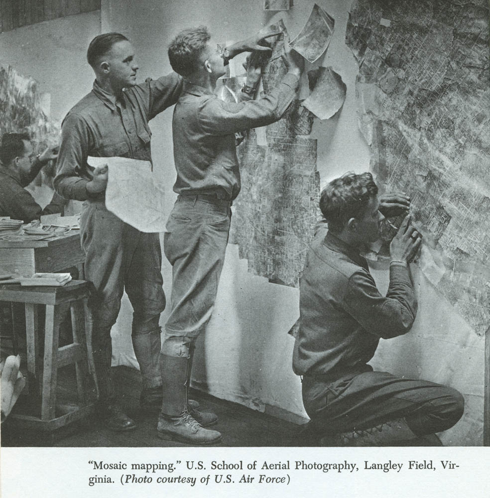
Later, Mosaic Maps were made by taking a series of overlapping vertical photos and putting them together to create a detailed view of the enemy’s trenches. This was enhanced by the use of stereoscopes, which was a device used to view two separate images which then made comparative studies of the imagery.
By then using skilled ‘interpreters’ the commanders could look for visual clues that denoted sometimes subtle changes in the enemy’s position, like soil displacement or shadows, which would often give away the position of trenches or artillery piece, as well as larger things like troop movements.
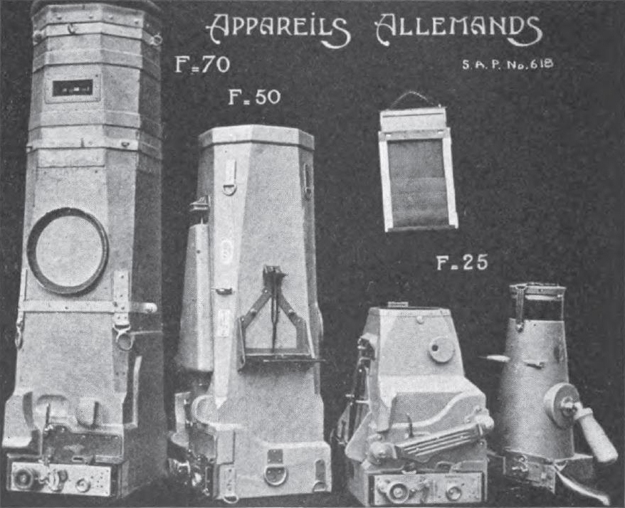
French military photograph of captured German aerial cameras. From “Airplane Photography,” Ives, 1920. (Wikipedia)
Increased Demand
With the success of aerial photography being noted at the highest levels of the British command, it wasn’t long before it was deemed as a necessity, rather than an additional tool.
In 1916 it became an integral part of the war effort and of the British Expeditionary Force’s intelligence-gathering and during the murderous Battle of the Somme, where some 600,000 men lost their lives, the RFC took more than 19,000 aerial images of German trench positions and reprinted them 430,000 times.
This, of course, meant that the number of photographic sections had to be increased to keep up with the now insatiable demand for this new innovation to the battle preparations and the squadrons were increased in line with demand.
Showing the Results
Prior to and during WWI, most senior officers would have been far behind the lines, directing the battles they were involved in from maps and information gleaned by roving cavalry units who would perhaps have hurriedly written information on scraps of paper. By the time it was in the hands of the prosecuting General it was usually out of date and worthless as the fight would have moved.
With the advent of aerial photography, this all changed and commanders were able to get information very quickly, which could then be acted upon and used to much greater effect.
Of course, it also meant that they and their subordinates could see first-hand the damage which had been done. Obliterated French and Belgian towns and villages could now be seen on film rather than in person, while battlefields littered with rotting corpses could also be viewed without having to suffer the choking stench of death.
Perhaps this ability to wage a war, miles from the actual fighting and detached from the real suffering of the ordinary men who fought and died in the mud and trenches, was something which helped to perpetuate the conflict. When it was abundantly clear that there were no military minds capable of unlocking the deadlock of a vicious slaughter, which showed no signs of abating, it is perhaps no surprise that the only thing they could think doing was more of the same.
While aerial photography was no doubt a groundbreaking advance for military commanders, their ability to use it effectively has to be called into question. With obvious strengths of positions and detailed information on troop numbers and artillery, it seems that it was still left to the infantry to be sacrificed in massive numbers in vain attempts to win ground.
Perhaps aerial photography had come too soon and was maybe something which was better suited to the more imaginative Generals who took part in the next great conflict, with their more mobile forces and the better understanding of modern weapons and tactics. Whatever it was, The Great War paved the way and changed the face of reconnaissance and intelligence for all time, setting a benchmark for all following wars and leaving generations to come with some of the most striking and unforgettable images we have ever witnessed.

