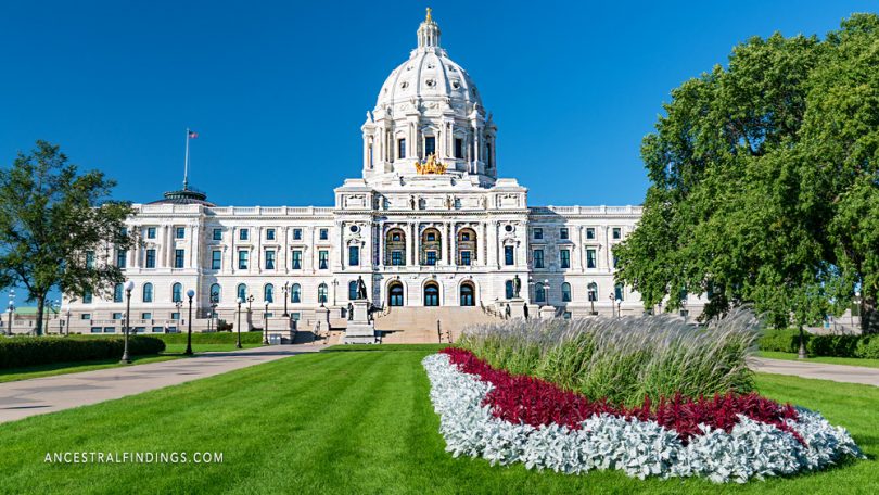
The state capital of Minnesota is the city of Saint Paul (most usually spelled St Paul). The city has a population of a little over 300,000 people and is the county seat of Ramsey County. Ramsey County is the smallest county in Minnesota while being the most densely populated one. St Paul borders Minneapolis, which is the largest city in the state. The two cities—one the largest and one the capital—are together known as the Twin Cities, as they practically meld into one another. In fact, the Minneapolis-St Paul area is the sixteenth largest metropolitan area in the United States, with a combined total of about 3.6 people.
St Paul was founded in the vicinity of some important Native American settlements and was originally used as an outpost for trading and transportation in the area. It was just another outpost at first but became a popular place for settlers when it was designated the Minnesota state capital in 1849. The Dakota Natives called St Paul Immizaska.
When European settlers first came to the area, they made their first homes at what was known as Pig’s Eye, which is at present day Lambert’s Landing. There was a popular tavern there that was set up early on in the history of European settlement of the area. After a priest named Lucien Galtier established the first location of the Cathedral of St Paul there (first known as the Log Chapel of Saint Paul), he announced that Pig’s Eye was to be known as Saint Paul from that point, and it was. He said the reason Saint Paul was a better name was because it “sounds good and it is understood by all Christian denominations.”

The area that is now Saint Paul was inhabited by Native Americans for at least two thousand years before Europeans came. Burial mounds from their culture in the area suggest this to be true. The Hopewell tribe was the first known one to live there, but others that are not known may have come before. The Mdewakanton Dakota tribe lived there from the early 1600s until 1837, and they were a branch of the Sioux tribe.
The Mdewakanton Datokas moved to St Paul after fleeing the Ojibwe tribe who pushed them from their ancestral home at Mille Lacs Lake. The name they gave the St Paul area, Immizaskadan means “little white rock,” because the area had exposed sandstone cliffs. Another tribe who lived there, the Menominee, called it Saenepan-Menikan, which means “ribbon, silk, or satin village.” This suggests that the St Paul area was an important location for trading among the Native Americans of the region, especially after the introduction of European products.
After the Louisiana Purchase in 1803, an officer with the US Army named Zebulon Pike negotiated with the local Dakota tribes to purchase around 100,000 acres of land in the Saint Paul region from them. This trade was done in 1805. In 1837, the US government negotiated a treaty with the Sioux that gave all of their land east of the Mississippi to the government. A local group of Kaposia Natives moved across the river to its southern banks and conducted business with French-Canadian traders.
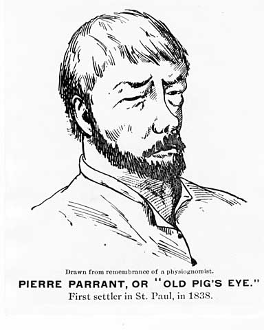
The US government built a fort in the area, and many traders, missionaries, and explorers who came to Saint Paul used the fort for protection. In fact, many of the first settlers of what would become Saint Paul were French-Canadian fur traders. Later, as trade in whiskey became a thriving business in the area, the fort stopped allowing non-military personnel to stay there, or on any lands controlled by the fort. To irritate the military officers at the fort, a French-Canadian settler named Pierre Parrant opened a fort just over the border of fort lands and called it the Pig’s Eye. The original name of Pig’s Eye for Saint Paul came from this tavern’s name.
After the settlement grew with the whiskey trade and the establishment of the Saint Paul church, a teacher from New York named Harriet Bishop came there and opened the first school in the city. At the time, Minnesota wasn’t even a territory of the United States, much less a state. Its territory status was formalized in 1849, eight years after the establishment of the church, and two years after the establishment of the school. At the formalization of the territory, Saint Paul was named its capital. In 1857, the legislature of the territory voted to move the capital to Saint Peter. However, a legislator named Joe Rolette, who did not want the capital to move, stole the text of the approved bill and went into hiding with it. Since the physical text could not be found, the move could not take place. When Minnesota became a state in 1858, Saint Paul was still the capital and is still the capital today.
The year Minnesota became a state, there were one thousand-plus steamboats working in Saint Paul. The city was a hub for travelers to the Minnesota frontier and to Dakota Territory. It was also the last place that boats coming upriver could unload their cargo, thanks to the stone bluffs in the northern Mississippi River Valley. Saint Paul was called The Last City of the East during this time. The railroad came shortly after statehood, making Saint Paul an even bigger and more important industrial city.
After the Civil War, there was a building boom in Saint Paul. Over the next century, skyscrapers, roads, highways, an interstate highway, and untold numbers of increasingly modern houses were built there. Downtown Saint Paul became an economically thriving area. In fact, when the interstate was built, Saint Paul already had a fully developed downtown and residential landscape, which made the project a challenging but successful one.
With a huge airport shared with Minneapolis, St Paul is still an important transportation hub for the region. To think it all started with a tavern called Pig’s Eye is pretty amazing. St Paul is a remarkable city.


