You may not have considered using maps in your genealogy research. In fact, even veteran researchers may not have used maps much, or at all. After all, what can an old map tell you except where your ancestor lived? The answer is, a lot more than you think. If you aren’t using maps in your genealogy research, you’re potentially missing out on a lot of interesting and even crucial information in piecing together your family tree.
Maps have been around since ancient times, though naturally, as technology in making them improved, so did their usefulness and accuracy. The first maps of North America that are known were made by European explorers more than five hundred years ago. Armies mapped out trails, rivers, forests, the placement of forts, and more. These assisted later exploratory expeditions in finding their way around, and later expeditions added to the accuracy of the maps.
When settlers began setting up camp in North America, surveyors came with them to partition large tracts of land, establish land offices, and keep records of who owned what land, and the boundaries of individually owned land. As the population of colonists moved into new places on the continent, the maps were expanded westward, southward, and northward.
Topographic maps became available in the 1800s, showing mountains, lakes, canyons, and other landforms. Insurance maps also appeared in that century, which drew actual neighborhoods and blocks, with individual buildings and the names of owners. Other maps of that century included information on population distribution, crops, weather patterns, gender, diseases, ethnic groups, and more categories of use to genealogists.
Many of these maps are available online and at local archives. Genealogists should look for them in the places where their ancestors lived? Why? There are a lot of reasons. Consider this one… a map can confirm boundaries of land and property.
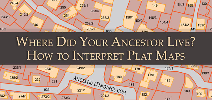
This is more important in your genealogical research than you may think it is. Do you actually know where your ancestors lived? You might think you do, but a map could tell you otherwise. If you’re looking up their street address from a census record on a modern map, there is a good chance that street names and numbers have changed over time. There are some historical streets that are no longer there and don’t appear on modern maps. The boundaries of where your ancestor lived may have changed at some point, as well. The boundaries of counties were redrawn a lot in the 1800s and early 1900s. The correct historical map can show you the actual location of your ancestor’s dwelling place, not what you think it is based on census records and modern map information.
With changing or unclear boundaries, many people in those times did not know exactly where they lived and cared even less. This meant that census takers sometimes skipped them, or that they would tell the tax collector from one state that they lived in another one. There often wasn’t enough proof of a person’s actual residence at a given time for the authorities of the time to pin them down to any particular location. When looking up addresses of historical ancestors on modern maps, it is always good genealogical practice to compare it to a historic map of the same area. The new information you discover may surprise you, chance your notions of where your ancestor lived, and even give you new research clues to investigate.